
Your Cart is Empty
Free Domestic Shipping Over $50 | 30 Day Returns


By Renee “She-ra” Patrick, Oregon Desert Trail Coordinator
I’ve been learning a lot about the history of the Blue Mountains Trail since setting out in August to ground-truth 100 miles of this potential 600-mile route. The current alignment of the route appears like a swirl around the stunning granite mountain ranges in north eastern Oregon, but diverges significantly from the original vision for this trail, born in 1960 on a horsepacking trip in the Blue Mountains.
In fact, what I initially thought of as a recent effort by the Greater Hells Canyon Council to create an immersive backpacking experience designed to engage the recreation community in conservation issues has a much longer and varied history than I could have imagined.
As with many good ideas, this one grew out of a love of place. Blue Mountains Trail founder and Oregon conservation icon Loren Hughes had a long and active relationship with the forests and rivers in the Blue Mountains. Just a few of his monikers include director of the Hells Canyon Preservation Council (now the Greater Hells Canyon Council), director of the Oregon Wilderness Coalition, and “Mr. Five Cent-er” a nickname bestowed after he successfully used one 5-cent stamp to appeal six US Forest Service timber sales. In addition, this tireless environmentalist was active in efforts to form the Eagle Cap Wilderness and North Fork John Day Wilderness...an incredible resume for a man who spent a significant portion of his livelihood as a jeweler in La Grande.

A young Loren Hughes - photo from GHCC

Save the Minam Crew - photo from GHCC
Loren’s vision gained steam when he appealed to friend Dick Hentze, an avid backpacker and Baker City school-teacher, to help him with the trail idea. The two spent the next several decades dreaming up their route, exploring possible alignments in the mountains, and with Dick’s love of maps, they created the first iteration of the trail, an 870-mile loop originally conceptualized as the Blue Mountain Heritage Trail.
What these men proposed was a circular route that touched Hillgard Station; a state park just north of La Grande (and a stop on the Oregon Trail in the mid-1800’s); followed the snaking river canyons of the Umatilla, Wallowa, and Wenaha Rivers; took a turn along the rim of Hells Canyon (the deepest river canyon in the country…yes…deeper than the Grand Canyon); to skirt the southern edges of the Wallowa Mountain Range and back into the mountains via the Burnt River and over to the John Day River drainages and back around to Hillgard Station.
Just a quick glimpse at a map reveals miles and miles of trails crossing all through these mountain ranges. It was surely a difficult task to decide what would be the best routing for their vision…I would guess there are hundreds of route options that would give hikers an immersive journey into the heart of north eastern Oregon. In fact, their research revealed the original route would encompass 2,000-miles of additional trails. Can you imagine?
At the heart of this trail effort was the Hells Canyon Preservation Council (which later was renamed as the Greater Hells Canyon Council or GHCC). The group was created in 1967 to stop Hells Canyon and the Snake River from being dammed, actions that later led to the protection of the area as the Hells Canyon National Recreation Area. The men played key roles in the efforts to honor the natural wonders of the area, and those who knew them well will be thrilled to know the trail is routed through the Wenaha-Tucannon Wilderness, Eagle Cap Wilderness, North Fork John Day Wilderness, North Fork Umatilla Wilderness, Strawberry Mountains Wilderness, Monument Rock Wilderness, Elkhorn Mountains, and Hells Canyon National Recreation Area.
2010 marked a big year for the Blue Mountains Trail. By that time the men had engaged another passionate outdoorsman and life-long eastern Oregonian, Mike Higgins. Mike had also been intimately involved in local environmental efforts, and served on the board of the Oregon Natural Resources Council (now called Oregon Wild) prior to getting involved in the resurrection of the Hells Canyon Preservation Council. Together the men had formed a nonprofit, partnered with the Forest Service, engaged interested parties in Baker City, and had generated considerable excitement in the local and recreation communities.

Mike Higgins - photo from GHCC
In fact, when looking back at several articles written about the trail in that time-frame, I was curious to find a major motivating factor for all parties involved was to help diversify the economy in the area and develop the recreation infrastructure that would attract foreign tourists to these far reaches of Oregon. A European backpacking-style experience was envisioned, and the route was designed to lead hikers to roads or trailheads every 10-12 miles or so where they could be picked up by a local inn or bed and breakfast, shuttled around each day, and essentially slack-packed the entire route (hiking with just a day-pack). Inspirations for this style of hiking can be found all over Europe like the Camino routes in Spain and different footpaths in England and Scotland.
However, routing hikers to roads and trailheads frequently meant they wouldn’t be experiencing the deep wilderness areas where bears, wolves, elk, and cougar still roamed freely. Trails can be designed with many different user experiences in mind, and this one was a noble effort at getting more people out in approachable sections of trail while spending time and money in the communities that serve as the backbone of this region. (I would definitely stay in some of those bed and breakfasts if they are still on the route today!)
Despite all the energy and excitement around the trail two-decades ago, a series of tragic events derailed the efforts, including a deep and personal loss in Dick’s life. The trail idea was still alive on the backburner, but major efforts to move it forward were at a standstill until 2016. At Loren’s unfortunate passing, the Greater Hells Canyon Council renewed their efforts to realize the Blue Mountains Trail and included it in their strategic plan.
Enter GHCC board member Jim Kennedy. Jim and his family loved exploring different landscapes on trails, and with the GHCC's renewed sense of purpose to complete the Blue Mountains Trail, he shared the vision with his son, Jared Kennedy. It sounds like Jared positively jumped at the chance to continue the dream, and the two of them poured over the previous trail materials with Mike Higgins.
Jared explained that he noticed some of the most iconic, scenic, and remote parts of the Blues were missing from the original route, so he set to work rerouting and revising the alignment to find a new way to tie the ecoregion together into a thru-hike. That’s about the time that I got involved in the effort, and over a series of phone calls and emails with Jim and Jared, I encouraged them to think of a route concept, similar to what the Oregon Natural Desert Association had created in the Oregon Desert Trail (or ODT, a 750-mile route that I have been working to establish for the last five years). I shared examples of the numerous resources that I had created for the ODT, and learnings from the relatively fast trajectory of the Oregon Desert Trail from idea to reality in just a handful of years.
An additional objective that Jared brought to the table was including the high peaks of the Wallowas, Elkhorns, Greenhorns, and Strawberry ranges. The three men also identified key peaks, wilderness areas, state parks, and towns they wanted to include in the alignment, and the current spiral shape of the now 600-mile path formed in response to these highlights.
Another reality set in when Jared, Jim, and Mike looked at the current landscape to find numerous fires had burned through some of the stunning sections of the route, and many miles of trails and roads had been neglected, ignored, or deliberately decommissioned. A tricky issue is that many of these routes still appear on maps, when in fact they don’t exist in a hikeable form today. Mining claims have popped up along sections of the trail (this area has a long long history of gold mining), private land boundaries have changed, and poison oak, blackberries, and deadfall create additional barriers on the ground.

The original Blue Mountains Trail is shown here in gray, with one of the first alignments of the “new” BMT overlaid in color.
This year Jared had a line on the map, and the goal was to find enough hikers willing to brave the unknown conditions to hike and document what was actually on the ground. I volunteered at first mention, and enticed some other experienced hikers I know to try and hike the entire route as well.
And what are we finding? An amazingly scenic and remote outdoor experience. Yes, some of the trails have been damaged by fire, are overgrown, and are blocked by tree-fall, but since there are several of us out hiking this year, we are exploring different options with the hope of finding an alignment (or as I like to say, the path of least resistance) that “goes.” If the Blue Mountains Trail can be hiked through a series of trails that are still in passible shape, connected to roads which bring hikers to and from towns, then later down the line some sweat can go into opening and clearing some of those neglected trails once again. As with many long-distance trails, each year brings changes in the mileage and in the alignment. This effort will be ongoing, but by using the route concept, the Greater Hells Canyon Council should be able to get folks out there hiking sooner rather than later and slowly work towards the deeper wilderness experience that still touches on the incredible communities found along the way. Although the European-style hiking concept will likely be modified from the original 10-12 miles between trailheads vision, I can easily imagine a scenario where a hiker can still get picked up from a trailhead, shuttled back to a cozy bed and hearty meal for the night, and whisked back to the Blue Mountains for the next leg of their journey.
There is so much more I want to explore about the Blue Mountains Trail concept, including the love of place this route hopes to inspire in the recreation community; the understanding of the Native American and homesteading histories of this region; the geology, habitat, and important ecological lynchpin nature of this area; the roles hikers can take if they are moved by their experience to get involved in the many conservation issues facing this corner of Oregon...there is so much more to say. Stay tuned for more explorations into the story of the Blue Mountains Trail...it will help prepare you for your hike out there when it’s ready to go!
Renee “She-ra” Patrick has been hiking long-distance trails for almost 20 years. She is a triple-crown hiker with well over 11,000 trail miles under her belt; the Blue Mountains Trail will be her 12th long trail. When she isn’t busy at work establishing the 750-mile Oregon Desert Trail, she can be found packrafting, rafting, backcountry skiing or just forest bathing.

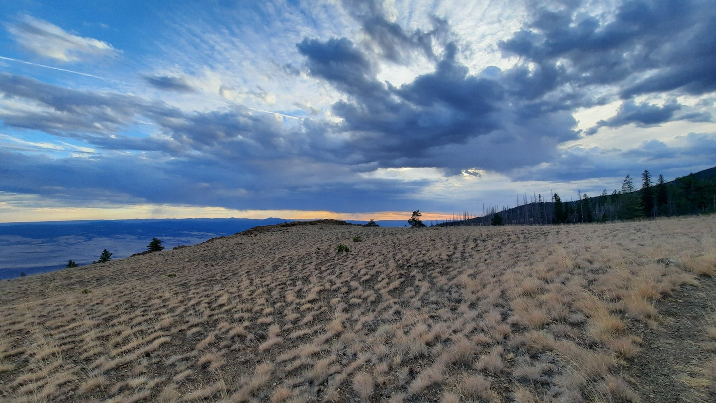
Approaching Strawberry Mountain - photo Renee Patrick